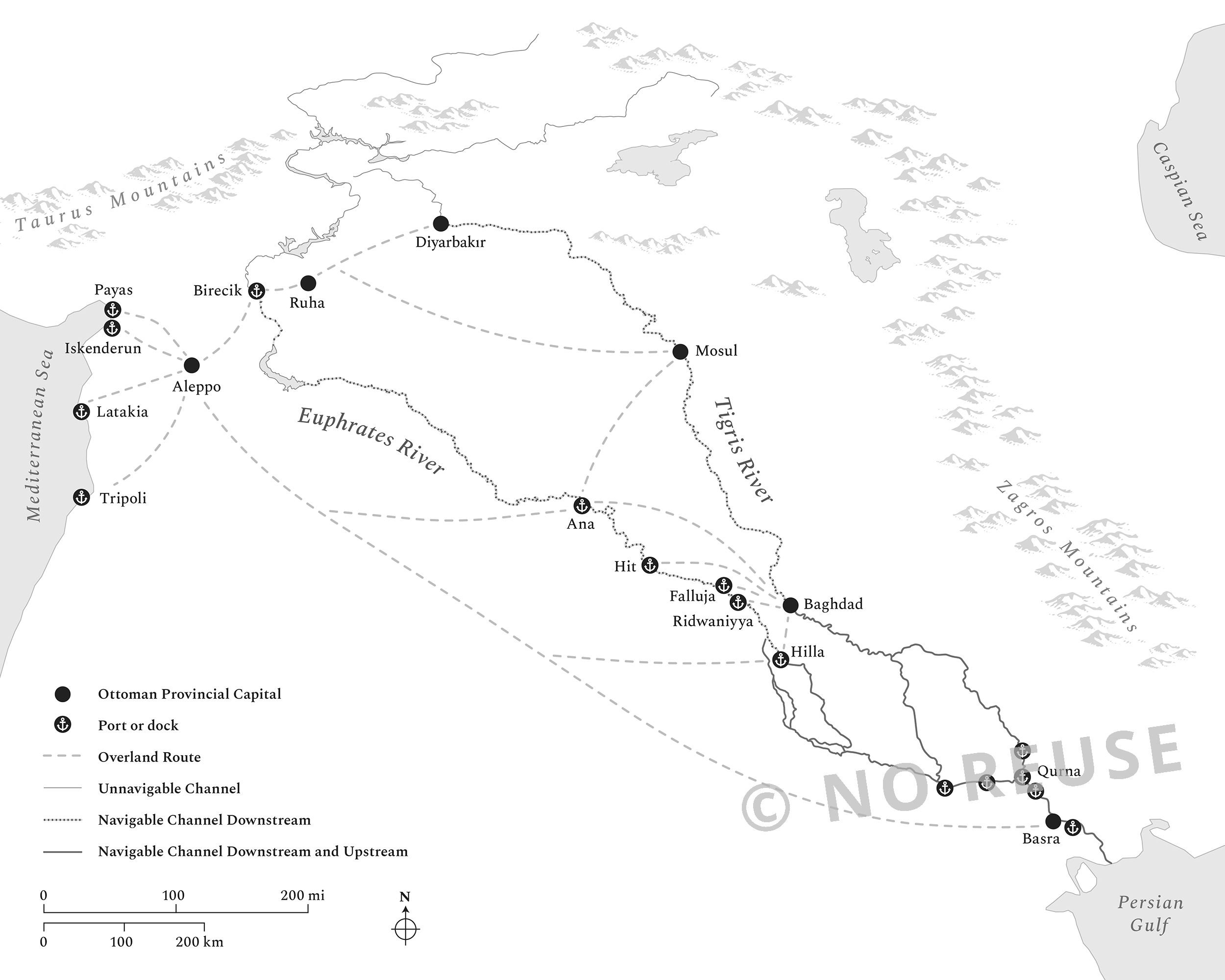
Rivers of the Sultan: The Tigris and Euphrates in the Ottoman Empire Book Diagram Project

I worked with environmental historian Faisal H. Husain (Pennsylvania State University) to create a series of 17 maps and 4 figures for his book, “Rivers of the Sultan: The Tigris and Euphrates in the Ottoman Empire” (Oxford University Press).

For the project, I created a style guide, and used GIS data and software alongside my typical graphic design software, in order to create a body of work that was consistent, stylish, and suitable for the print specifications.