Traditional Potawatomi Homelands Map
In-house with WeatherstonBruer Associates
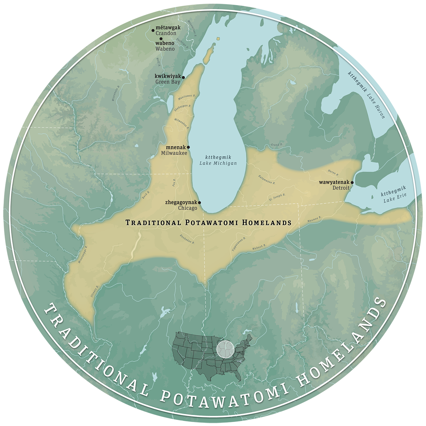
As part of the the redesign of the Forest County Potawatomi Cultural Center, Library and Museum (scheduled to open 2021) I created a map of the Tribe’s traditional homelands relative to relevant reference points (including Crandon, Wisconsin, the contemporary site of the Center). The graphic combines client-supplied references, gallery style guides, and geodata to create a > 5-foot diametre mural that anchors one of the Museum’s permanent exhibits.
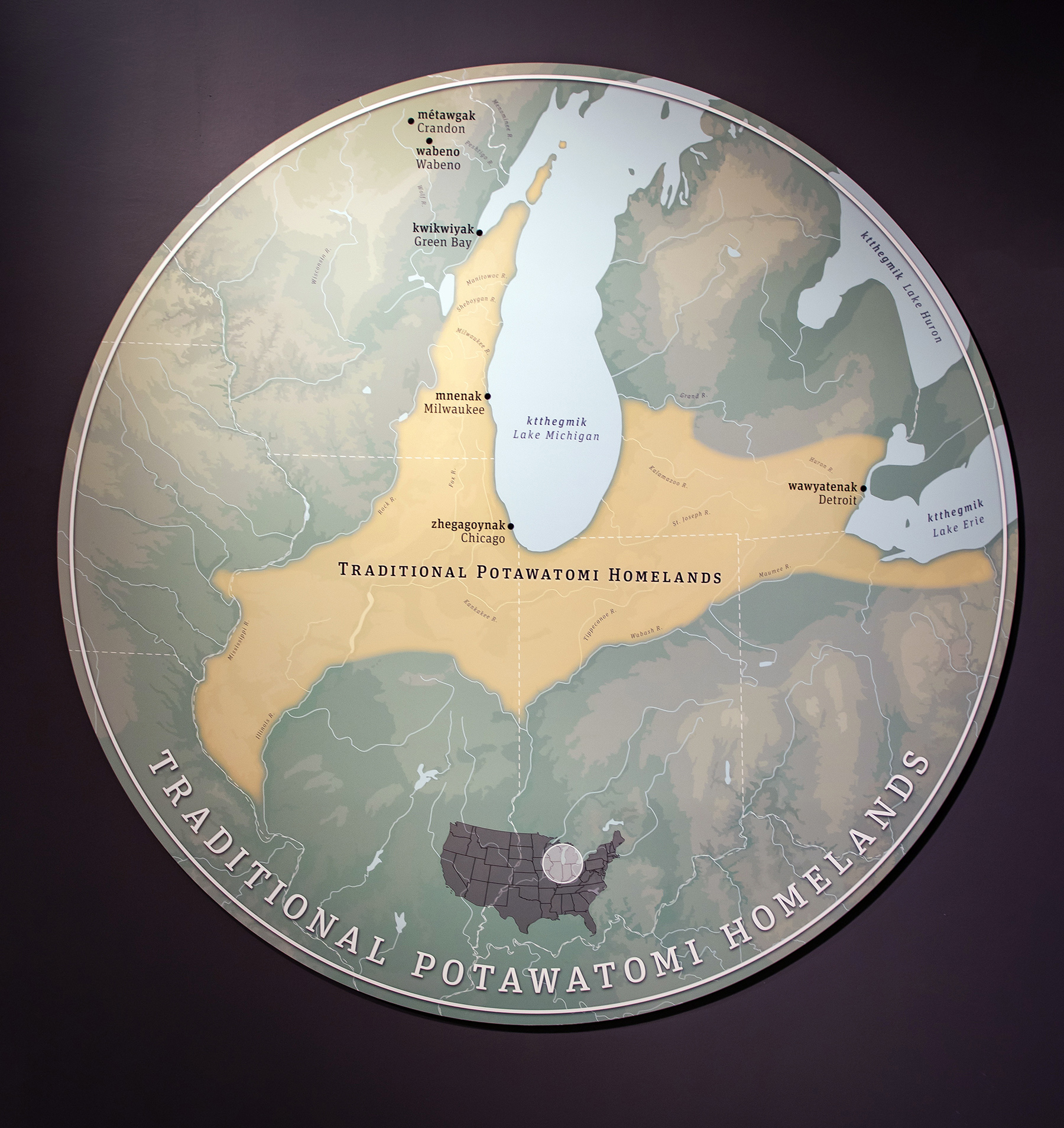
Exhibit photo: Valerie Niehaus / Potawatomi Traveling Times